
Single, Manual and Auto Mode
All three modes save latitude and longitude to the photo (and altitude when available). See Supported Metadata for details on supported tags.
You choose whether the city, state, country and elevation are saved to the photo in GPSPhotoLinker preferences. GPSPhotoLinker queries either Google(default), Microsoft's Terraserver [terraserver-usa.com] or geonames.org to find the city, state and country corresponding to the latitude and longitude data.
Single
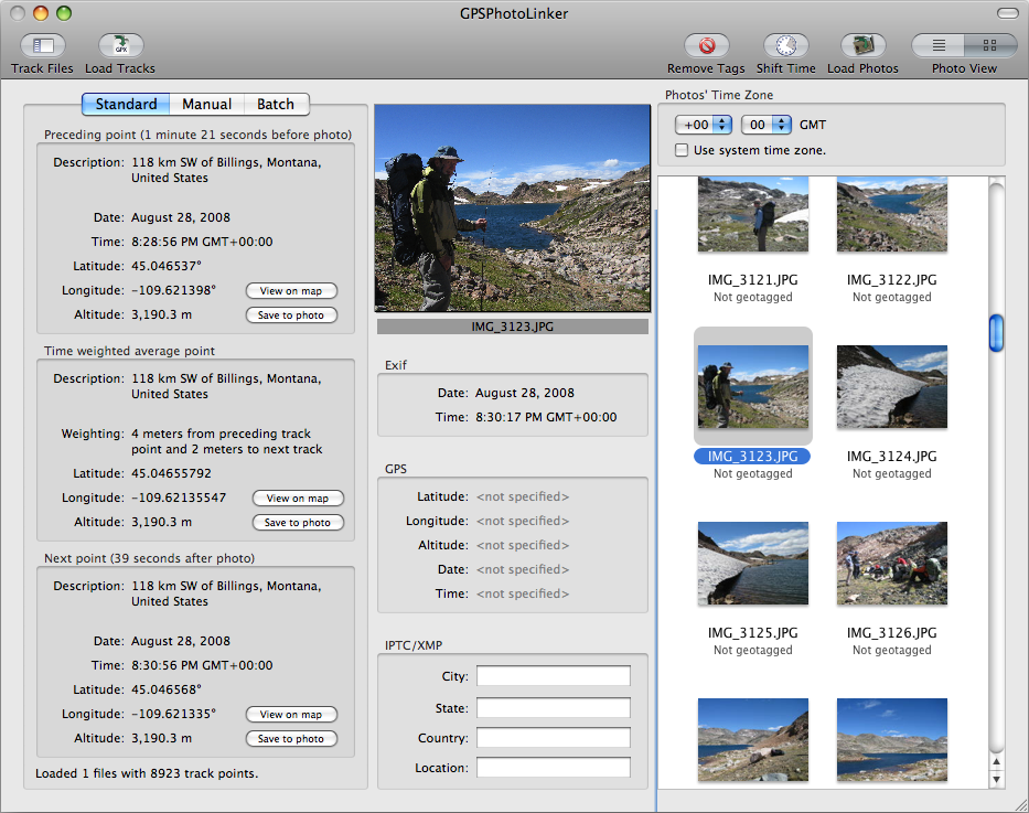
Click for the full screenshot.
When one photo is selected, Single mode displays the two track points closest in time to the time stamp on your photo. The "Preceding point" is the closest track point in time prior to the time stamp on the photo. Similarly, the "Next point" is the closest track point in time after the time stamp on the photo. Although not a real track point, there is also a "Time weighted average" latitude/longitude you can choose to save to the photo. Clicking "Save to photo" on any of these options will immediately save the latitude and longitude to the photo.
Manual
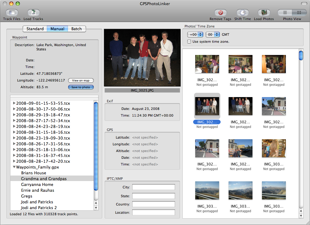
Click for the full screenshot.
Manual mode allows you to browse all the waypoints and track points recorded in the loaded track files. Each waypoint or track point can be viewed on a map and/or selected and saved to the photo(s).
Additionally, you can enter your own coordinates and elevation by selecting "Photos > Enter Custom Coordinates..." from the menu bar. If you use this option frequently, you can add it to your toolbar by selecting "View > Customize Toolbar".
Auto
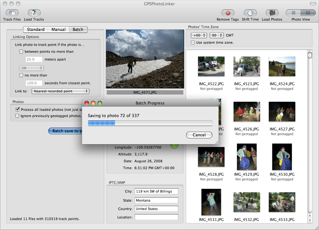
Click for the full screenshot.
Auto mode automatically links track points to your photos based on your selected criteria. This is a highly efficient method for processing many photos at once.
The linking options allow you to choose when a track point will be saved to a photo.
- The first option allows you to place a restriction on the physical distance between the two track points surrounding the time the photo was taken.
- The second option allows you to place a restriction on the temporal distance between the nearest track point and the time the photo was taken.
- Selecting AND requires both critieria to be met before linking will occur. Selecting OR will link if one of the two criteria are met.
- You can choose to link the nearest recorded point in time, or the time weighted average point (if one exists, otherwise the photo will be ignored).
- If no time or distance criteria are selected, linking will occur to the nearest recorded point or time-weighted average (as selected) without restriction.